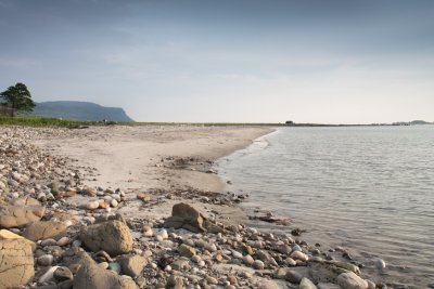
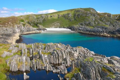
With immaculate white sands and crystal-clear waters, you would be forgiven for mistaking some Isle of Mull beaches for a more tropical destination – until you dip your toes, that is! The island has 300 miles of coastline, with sweeping bays like the white sands of Calgary or the silver sands of Ardalanish, as well as lesser-known coves, tucked beyond view of the roadside. Whether you're staying in the island's north, east, south or west, discover the beautiful Isle of Mull beaches you could explore, with map markers to guide the way and local tips to head off the beaten track if you wish.
Call us on 01688 400682
Beaches on the Isle of Mull
Map of the Beaches
North Mull

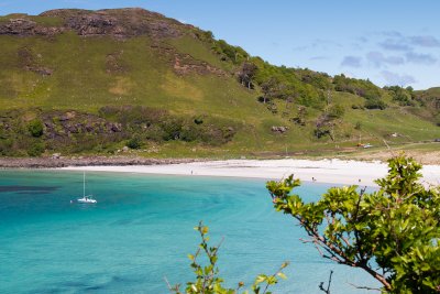
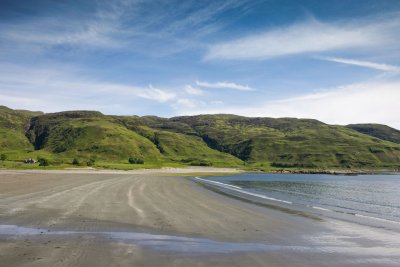
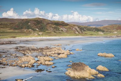
Calgary Beach
Picture the scene of an island beach and you'll imagine Calgary. Turquoise blue, crystal clear waters gently lap onto the white shell-sand beach, where a burn meanders down one edge of the cove to meet the incoming tide. Calgary Beach is Mull's most famous and popular beach and it's little surprise, promising a sheltered walk over the sand and tempting waters to take a dip or even spot fish in.
It is also one of the larger beaches on the Isle of Mull, and has some nice dunes leading into machair grasslands that bloom beautifully in the summer, as well as being the starting point for the superb coastal walk to Caliach Point. Access is easy, with parking close to one end of the beach, and there is also a camp ground area with toilet facilities.

Langamull
Lesser known than the popular Calgary Bay but equally as beautiful, Langamull is a hidden gem of Mull's north coastline between Dervaig and Calgary. One half of the bay is a patchwork of sand pockets and machair grasses with a small freshwater burn winding to the sea, the other half is more of a classic sandy bay, which is a great place for swimming, and offers good shelter from any breeze.
Perch on the rocks for a picnic and soak up the views out to Rum after enjoying the 30-minute walk down to the beach from the Forestry Enterprise Carpark, signposted along the Dervaig to Calgary road. There's also the option to extend your walk by peeling off to visit the ruined village of Kildavie on your way back.

Port na Ba
Arriving into Croig Harbour is as enchanting as it gets, with just a handful of houses and an old stone fishing pier that is still worked to this day. From here, you can explore the coastline to discover several small bays, following a track for about 20 minutes to get there.
Cast your gaze across the sea to take in views of the islands of Muck, Rum and Skye beyond, before arriving at the charming sandy coves. Port na Ba is among them - a favourite among locals and a brilliant vantage point from which to take in the sunset.

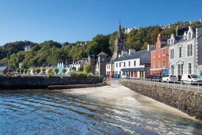
Tobermory Beach
Yes, even Tobermory has its own little beach, when the tide is right. This one's very easy to find, being located right on the harbour front, beside the fishing pier. When the tide is out, a larger expanse of sand is exposed, and its central location makes it popular with kids while the parents do the shopping across the road!
With the Isle of Mull Ice Cream parlour only a stone's throw away, Tobermory's wee beach offers the perfect accompaniment to your locally made sweet treat, or on a dreich day, a warming coffee from the bakery or cafe.

Traigh na Cille
A hidden gem on the island's west coast that is loved by those who know where to find it. Dark grey sands await as you descend the gentle path from the roadside at Torloisk towards the beach, with wonderful views out to Ulva and Gometra. Hidden from view at the roadside, you can often enjoy the beach to yourself, and it's a popular spot among locals to swim.
As with many of the island's beaches, the rocks that hug the sand are decorated with the pink blooms of sea thrift in early summer, with light shade cast from the handful of surrounding trees - a lovely spot for a picnic on a sunny day, or to tie in with a trip to the nearby island of Ulva.
Central and South East Mull

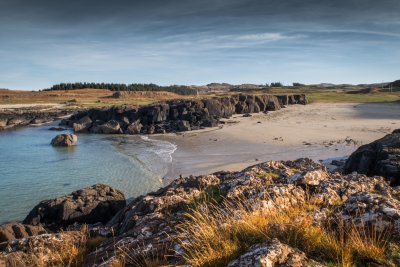
Port Donain
Situated in Mull's southeastern corner you can discover the fine grey sands of Port Donain beach.
There is a small bay in the rocky coast and the main beach sits to the head of it. A popular stopping point for kayakers in the summer months and a favoured hangout for Mull's pungent smelling wild goats in the winter season!

Duart Beach
Small but perfectly formed, a visit to this wee sandy cove makes an excellent addition to your tour of Duart Castle and lunch at the Tea Room, the latter of which is where the short route down to the beach begins. Enjoy the surrounding views of the hills and, at low tide, explore the sand flats of Duart Bay too. A great way to weave a taste of the beach into your day's excursions as you explore the south east corner of the island.

Laggan Sands
A lovely, sweeping beach in the south east of the island, Laggan Sands are reached via a very pleasant walk along the shorefront at Lochbuie.
Park beside the shore and treat yourselves to a coffee at The Old Post Office, before bearing east along the coast to head for the beach. You'll pass rocky shoreline, patches of sand and enjoy birdlife aplenty as you make your way, passing the ruins of Moy Castle before you round the coastline and approach the beach.
With pale grey sands and superb views west over the Atlantic to the island of Colonsay on a clear day, the beach offers an excellent walk at any time of the year, with a mausoleum to visit at one end of the beach too. You'll often find the only others on the beach to be the local population of Highland cows.

Port a' Bheoil Mhoir
This beautiful tidal beach lies along the coastal path from Lochbuie to Carsaig, a perfect place for a dip on a hot day and great for watching out for wildlife too. Much like Laggan Sands, you can park in the designated area on the shorefront at Lochbuie, but this time, hug the coastline heading west, where forested hillsides tumble down to the path, which is lapped on the other side by the shore.
It's possible to walk all the way to Carsaig from here, but for a shorter excursion, Port a' Bheoil Mhoir makes a beautiful destination in its own right.

Croggan Beach
Park at the road end and wander through the dappled woodland along a delightful track around the rocky headland of Croggan. Tiny waterfalls trickle down the rocks, which are packed with primroses in spring, while the tide laps to the other side of the path as it enters Loch Spelve, a popular spot for otters. The walk takes 20 minutes with beautiful sea views all the way and you can even see as far as Ben Nevis on the mainland on a very clear day.
Arriving at the beach, grey sands decorated in shells await your exploration, with numerous rock pools to investigate too. Woodland backs the sands, making the beach feel private, and it's not uncommon for you to encounter an inquisite seal in the water.

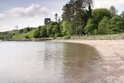
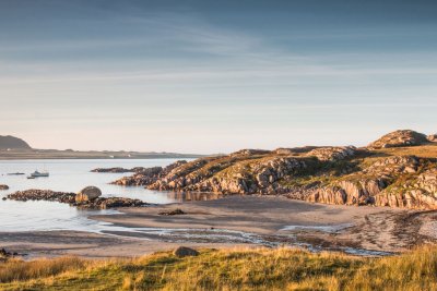
Port an Tobire
An excellent choice if you're staying in the centre of Mull, within easy reach from Fishnish, Aros and Salen, Port an Tobire is one of two beaches that can be found beside the 13th century Aros Castle, the other being Port nam Buitsichean. Both are mainly sandy with patches of shingle, with good views down the Sound of Mull and the stunning backdrop of the castle ruins. Starting from the stone bridge just north of Salen, both beaches are easily reached with a short walk.

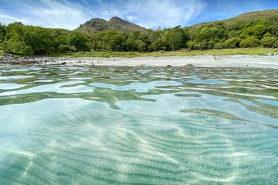
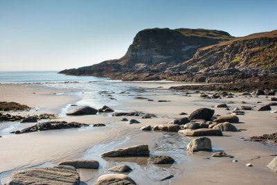
Gribun Beach
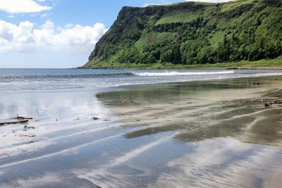
There can be few more dramatic locations for a beach than this. The huge Gribun cliffs tower beyond the beach, which sits on the shore of Loch na Keal, a sea loch that is popular for its abundant wildlife.
Easily reached from the roadside, you can take in views across to the island of Inch Kenneth and the north shore of Loch na Keal, watching the occasional fishing boat pass by. The rocks here are of geological interest too, with seals, eagles and otters often spotted in the area.
Ross of Mull

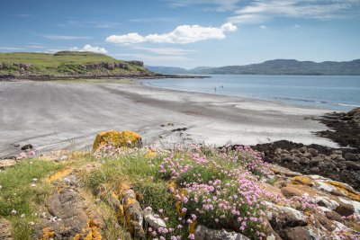
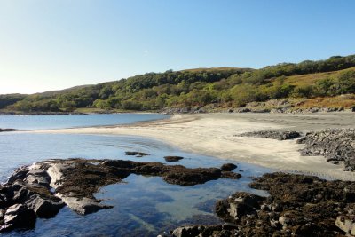
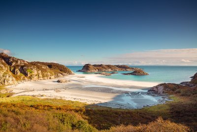
Fidden Beach
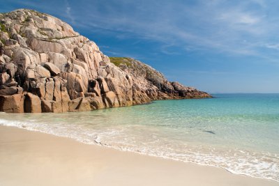
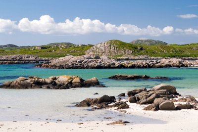
Another firm favourite of locals and visitors alike on the Ross of Mull, Fidden beach blends beautiful expanses of white sands with pink granite rocky outcrops, that offer shelter to the bay and make the waters here a lovely place for a paddle or swim as you cast your gaze across to the island of Iona in the distance.
As the summer months arrive, the machair surrounding the beach springs into bloom for a beautiful display - a natural gem of the Hebrides and west coast of Scotland. Follow the road from Fionnphort towards Fidden and it's a short walk from the farm down to the beach.
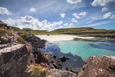
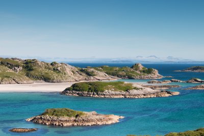
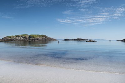
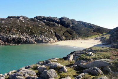
Knockvologan
The large expanse of white sandy bays at Knockvologan are truly stunning. The colour of the rocks, water and sand come together to create a coastal experience that feels truly special, and is a landscape photographer's paradise.
There are many bays in which to sunbathe, and there is the opportunity to explore the sandbars and small skerries that get cut off by the tide. When the tide is right, you can even cross over to the Isle of Erraid - just make sure to plan your return before the tide comes in.
Located just around the coast from Fionnphort, you can park at Knockvologan farm, then make your way down the track to reach the coast in ten minutes.

Carsaig Beach
A striking contrast to many of the island's white shell-sand beaches, Carsaig Beach boasts dramatic, dark grey sand and a spectacular location surrounded by cliffs. Even the drive to get there feels exciting, descending past steep hillsides and the waterfall beside the iconic red phone box on the way.
It's only a short walk onwards to reach Carsaig Beach, often frequented by wild goats and the resident population of seals. With more waves than many of Mull's beaches, it makes an excellent addition to any beach-hopping itinerary.

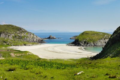
Traigh Bhan
Traigh Bhan sits on the Isle of Mulls south coast below the ruined cottages at Shiaba, and is best explored on a low tide. This beach was used as a port by the villagers to bring goods from boat up to Shiaba.
To get here, you'll first need to follow the road from Bunessan to Scoor, which becomes a rough gravel track for the final few miles, then leaving the car behind and donning your boots, walk around the coast over the hilltops to reach Shiaba, where the remains of several cottages and buildings serve as a reminder of the community that once lived and worked these breath-taking landscapes.

Uisken
One of the island's most accessible beaches, Uisken is a stunning sandy bay and certainly holds its own among the Ross of Mull's many beautiful beaches. Located south of Bunessan and not far from Ardalanish, you can park right besides the sands - ideal access if you want to launch a kayak too.
Small islands in the bay keep the waters sheltered, so it's a prime spot for paddling. For those who fancy an amble, there is a good lookout cairn at the eastern end of the beach, which offers excellent views.

Fionnphort Beach
Set just below the village, Fionnphort beach is a sandy expanse that has a distinctive split granite boulder at its centre. Thanks to its location on the south west coast, you have fantastic views across to the island of Iona, and it's a great spot for photographing the sunset, too.
Easy to find, park in Fionnphort and head for the pier and you'll soon see the beach - a lovely spot for a picnic lunch while you wait for the Iona ferry to come in, or for a final paddle before heading back to the cottage for the evening.

Kilvickeon Beach
A secluded beach near Scoor, the white sands of Kilvickeon are spilt into two by a small island that creates two bays, each equally beautiful, and more bays await along this stretch of coastline if you do a bit of exploring.
Take the road close to Bunessan signposted towards Scoor - after a short distance the road becomes a rough gravel track, so you'll need to take it slow. The road passes Loch Assapol before climbing towards Scoor, where there's a small parking area, from which you can follow the short path down through fields to the beach, with a handy map at the car park showing you the way. For keen kayakers, you may also choose to paddle into the bay and experience it from the sea.
Ardalanish
One of Mull's best beaches for beachcombing after rough seas and a coastal walk when the weather is fine. Ardalanish is a single long stretch of white sand backed by sand dunes and machair, which come the summer months is abuzz with pollinators and covered in flowers in every colour. Challenge yourselves to name a few!
Once on the beach, the sand stretches in either direction, allowing for an enjoyable stroll, reaching rockpools and rocky headland, before retracing your steps. It's also a popular spot for sunbathing and a swim in the summer months, with fine views out to sea and a short walk back up to the car to dry off.
Ardalanish Beach is easy to find. Take the signposted road to Uisken and turn right down to Ardalanish's Weavers - there's a parking area on the left before you reach the Weavers. From here, it's a short walk to the beach.

Traigh Gheal
Not an easy beach to reach, but breath-taking when you do. To experience Traigh Gheal for yourself, you'll first need to hike through is the Tireragan Nature Reserve. This is definitely a beach where walking boots are required, crossing difficult terrain with the help of wooden bridges and planking along the way.
The reward for your efforts are the beautiful white sands, backed by rugged hillside, and sheltered by a few outlying rocky islands. Given the challenging nature of exploring this beach, there's also a very good chance of having it to yourselves!

Traigh na Margaidh (Market Bay)
One of just a few white sandy bays on the north side of the Ross of Mull, located between Fionnphort and Bunessan. Begin by making the 30-minute walk along the track to Camas, then follow the sign to Market Bay, which leads to this tranquil beach. Its secluded location makes it feel incredibly private when you have the beach to yourselves - little wonder it is apparently popular with the Royal family who have had picnics here!
From the beach, you can enjoy superb views back across to Mull's wilderness headland - the Ardmeanach peninsula, as well as the beautiful seascapes and white sands.
Dun a'Gheird Beach
Another of the Ross of Mull's lesser known beaches that requires a sense of adventure - although a relatively short walk - to reach it. Dun a'Gheird is actually the name of the hill fort that is located above this most picturesque of beaches, which is sheltered by incredible rock formations on the island's south west coast.
Head west from here and you'll discover even more sandy coves, where you're likely to be the only people on the beach. Close to Kilvickeon beach, venture down the Scoor road from Bunessan, which becomes a rough gravel track for the final few miles, to explore the stunning coastline here.

Traigh a' Mhill
Traigh a' Mhill is a small secluded cove along Mull's south west coast just south of the larger Knockvologan beach. The waters are a stunning shade of blue, backed by pink granite that the Ross is so well known for, and offer another quiet spot to sunbathe or swim in fine weather. Exploring the coastline in this area is often very rewarding, with many hidden beaches to find for those who know where to look.